Supercharger site maps arrive in the Tesla app
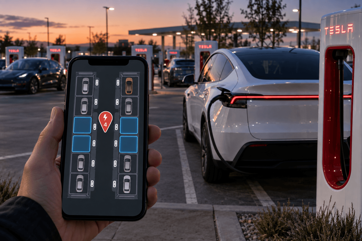
Tesla is adding detailed maps of Supercharger locations to its smartphone app. Starting with app version 4.61.0, drivers can view supported charging sites from a bird’s-eye perspective before entering the premises.
The view shows individual charging stalls, their current availability, traffic lanes, parking areas and structural obstacles. This can make it much easier to find the correct entrance, particularly at larger charging sites, complex parking garages or Superchargers located on hotel grounds.
Select a location, check the layout, head for an available stall: The new map view is designed to prevent unnecessary laps around the parking lot.
How the app and in-car display differ
In the vehicle, Tesla presents supported locations as a freely navigable 3D environment. The smartphone version is intentionally simpler, using a fixed overhead view that users can zoom in and out of.
| Feature | Tesla app | In-car display |
|---|---|---|
| View | Overhead view with 3D elements | Interactive 3D environment |
| Controls | Zoom and pan | Zoom, pan and rotate |
| Live availability | Yes | Yes |
| Traffic lanes and obstacles | Yes, where mapped | Yes, where mapped |
When users zoom in, the app loads a dedicated map layer for the Supercharger. This replaces the details of the standard Apple Maps view with Tesla’s site-specific visualization of the charging facility. There may be a brief delay before this layer appears.
From 18 pilot locations to a major US rollout
The Supercharger site maps debuted with the 2025 Holiday Update at 18 test locations in California and Texas. Tesla subsequently expanded coverage to Canada and large parts of the US.
Scaling the feature is a complex process because every location must be digitally mapped with its charging stalls, entrances and obstacles. Tesla said its mapping team had at times achieved a pace of more than 300 new locations per week. The global Supercharger network now comprises more than 80,000 charging stalls.
What does this mean for Germany, Austria and Switzerland?
The app version alone does not guarantee that a site map will be available for every Supercharger. The key factor is whether Tesla has already mapped the relevant location and enabled it for the new view. Comprehensive availability across the DACH region—Germany, Austria and Switzerland—has not yet been confirmed.
In principle, the feature is not tied to a specific vehicle. It can therefore help drivers of a Tesla Model Y just as much as owners of a Tesla Model 3, provided both the app and location are supported.
In everyday use, the benefit is likely to be most noticeable at large or confusing charging sites. Seeing an available stall means less maneuvering and less time lost upon arrival. Drivers towing trailers can also use the layout to better assess which charging stall is suitable.
Cybercab appears first on smartphones
One interesting detail concerns Tesla’s Cybercab. The mobile view already has a dedicated 3D model for the autonomous vehicle, while the in-car display still sometimes depicts it as a conventional car.
For now, this is mainly relevant in Austin, where Cybercabs are operating as robotaxis. For European Tesla drivers, the more important point is that the app now does more than simply count available charging stalls: It also clearly shows their exact positions on the site.